search
Plaka Athens map
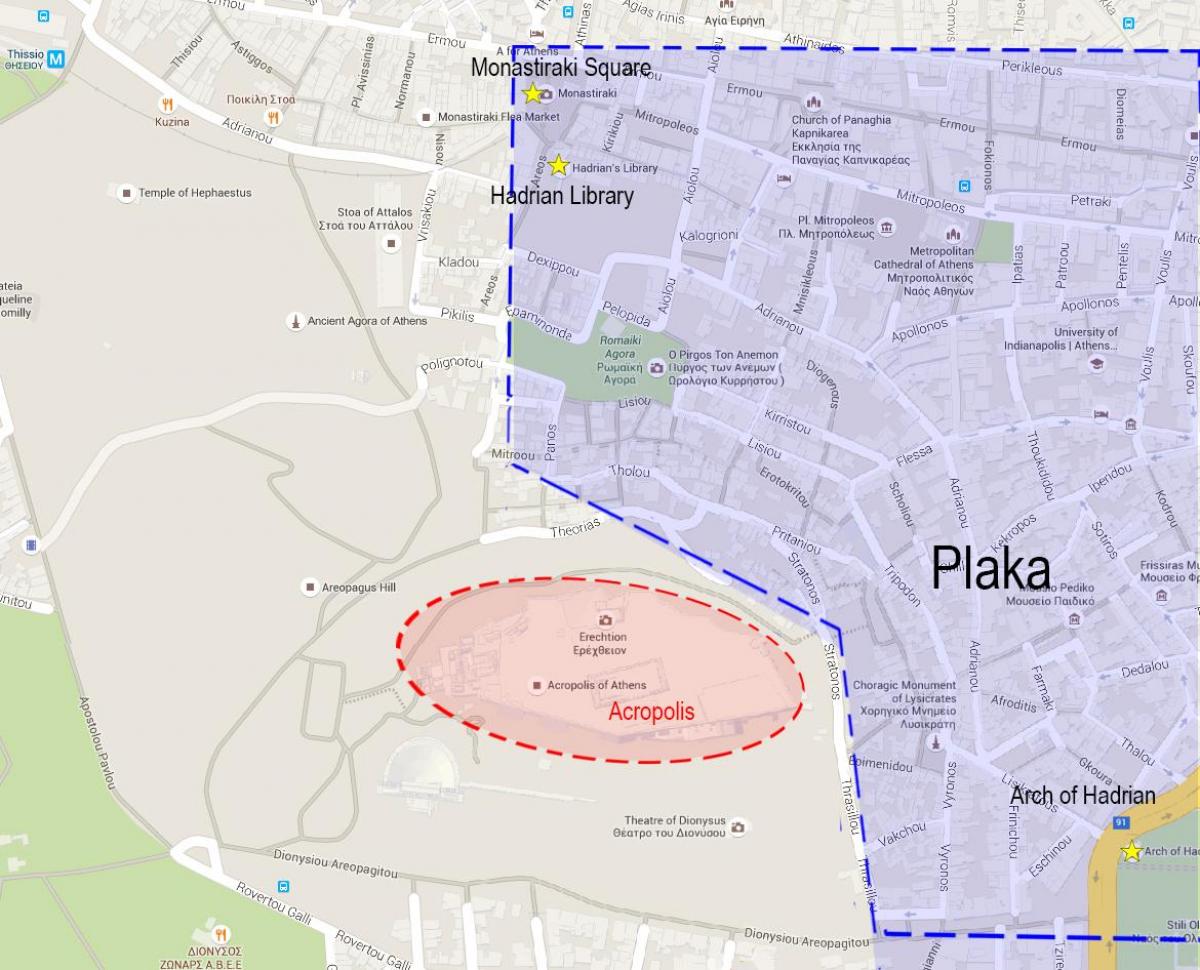
Map of plaka Athens greece. Plaka Athens map (Greece) to print. Plaka Athens map (Greece) to download. Also known as the District of the Gods because of its proximity to the Acropolis (as is shown in plaka Athens map), plaka Athens is the oldest district of Athens, as well as one of the most attractive and lively areas of the city. Conveniently, plaka Athens is located at the foot of the eastern part of the Acropolis, the picturesque neighborhood of Plaka is next to other areas of interest such as Anafiótika and Monastiráki.
Plaka (Πλάκα in Greek) is a picturesque district of Athens map. Plaka Athens is located right at the foot of the Acropolis. This district is both the historical and touristic heart of the Greek capital. There is a maze of small narrow streets with stairs in plaka Athens, low houses with flowers, abundant vegetation in places, no or few cars, many cafes and taverns, this is a place full of charm, absolutely essential.
The origin of the word Plaka is uncertain and gives rise to multiple interpretations. In modern Greek, the term "Plaka" has a double meaning. Plaka Athens means "joke". It also means "paving stone". It is also believed that the name Plaka comes from the Arvanites, an Albanian population that emigrated to Greece and lived in that part of athens. The Arvanites nicknamed the neighborhood where they lived "Pliakou Athens," which meant "Old Athens. In the course of time, "Pliakou" would have been transformed into "plaka"(see plaka Athens map).


