search
Athens railway map
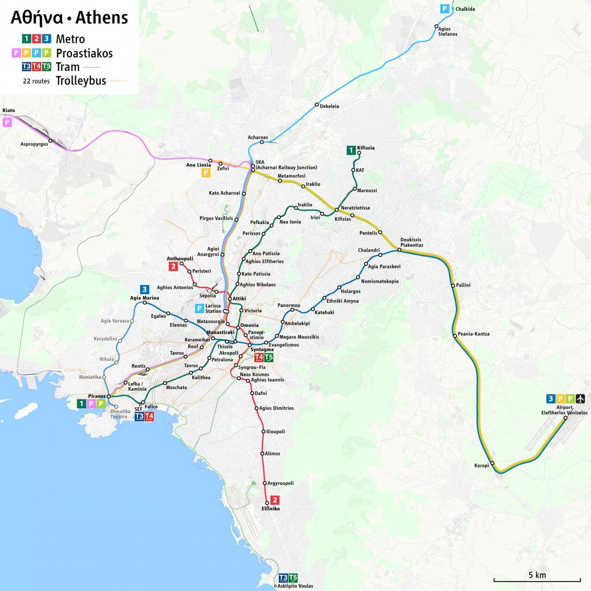
Athens suburban railway map. Athens railway map (Greece) to print. Athens railway map (Greece) to download. The Suburban Railway, or “Proastiakos” (as its mentioned in Athens railway map), is part of the national railway network of Greece and is operated by private company TrainOSE. The Athens railway has 3 main routes are Piraeus – Athens Central Station (Larissa station) – Airport, Piraeus – Athens Central Station – Kiato and Athens Central Station – Halkida. There are also extra trains between Ano Liosia and Airport station as well as Ano Liosia and Koropi stations.
From summer 2020 there are also trains connecting Athens Airport (as well as Piraeus) directly to Egio, near Patras (as its shown in Athens railway map). Be aware that different fares apply: the standard 90-minute ticket for the Athens region covers all Proastiakos journeys from Piraeus to SKA and Magoula to Koropi stations, while different fares are charged for more distant stations. See also: Athens Suburban Railway discount policy.
Athens Suburban Railway connects Attica to the surrounding region, including main cities such as Kiato and Chalkida, which are connected directly to Athens centre, Athens International Airport «Elefterios Venizelos» and Piraeus port (as its mentioned in Athens railway map). Athens Suburban Railway offers to thousands of passengers the choice of an affordable, fast and reliable transportation to and from their workplace. At the same time, Athens Suburban Railway offers access to major archaeological sites and tourist destinations, close to Athens, enabling residents and visitors of Athens and those of the surrounding region to enjoy small excursions. New itineraries, via Suburban Railway, connect Aigio with the surrounding area, International Airport of Athens, Athens and Piraeus.


