search
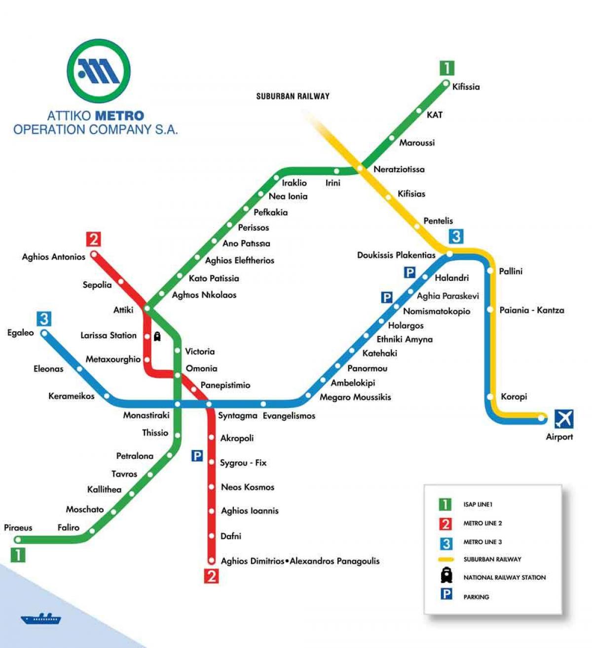
Athens airport metro map
Map of Athens airport metro. Athens airport metro map (Greece) to print. Athens airport metro map (Greece) to download. The most convenient and quickest option to get to Athens from the airport is to take the metro (see Athens airport metro map). The fare is €10 (US$11.80) and allows connections between different lines and other means of transportation for 90 minutes. There are special fares for 2 people (€14 (US$16.50)), 3 people (€20 (US$23.60)) and those over 65, under 18 or university students under 25 (€4 (US$4.70)). The first metro leaves the airport at 06:35 and the last one at 23:35. The estimated time to reach Piazza Syntagma is 40 minutes.
The metro has a big advantage: it avoids traffic jams. During rush hours, it can be faster than a cab. Line 3 (blue) connects the airport directly to Athens center (as its shown in Athens airport metro map). The metro serves Syntagma and Monastiraki stations, among others, and can be reached from the arrivals hall by subway in about 10 minutes on foot. Exit at Gate 3 of athens airport, go up the stairs in front of the Sofitel Hotel and take the footbridge. It takes about 45-60 minutes by metro to reach downtown Athens. From the airport, there are metro trains every half hour from 6:30 am until 11:30 pm.


