search
Acropolis museum map
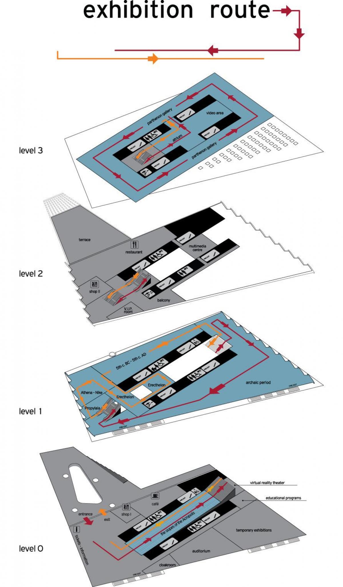
Map of acropolis museum. Acropolis museum map (Greece) to print. Acropolis museum map (Greece) to download. In 1833, the Turkish garrison withdrew from the Acropolis. Immediately after the founding of the Greek State, discussions about the construction of an Acropolis Museum on the Hill of the Acropolis began. In 1863, it was decided that the Museum be constructed on a site to the southeast of the Parthenon map and foundations were laid on 30 December 1865. The building program for the acropolis Museum had provided that its height not surpasses the height of the stylobate of the Parthenon. With only 800 square meters of floor space, the building was rapidly shown to be inadequate to accommodate the findings from the large excavations on the Acropolis that began in 1886. A second museum was announced in 1888, the so-called Little Museum. Final changes occurred in 1946-1947 with the second Museum being demolished and the original being sizably extended.
The Acropolis Museum is an archaeological site-specific museum, housing more than 3.000 famous artefacts from the Athenian Acropolis, the most significant sanctuary of the ancient city. Located in the historical area of Makriyianni, southeast of the Rock of the Acropolis map, the Museum narrates the story of life on the Rock from prehistoric times until the end of Antiquity. From its opening in June 2009 until March 2012 more than 4 million local and foreign visitors have passed through the Museum doors. Architect Bernard Tschumi new Acropolis Museum replaced the old Museum on the Rock of the Acropolis. The new museum has a total area of 25,000 square meters, with exhibition space of over 14,000 square meters, approximately ten times the size of the old Museum.


