
search
Proastiakos map
Map of proastiakos. Proastiakos map (Greece) to print. Proastiakos map (Greece) to download. The suburban railway (Proastiakos) is a relatively new choice of public transportation of Athens. Proastiakos services suburbs of Athens that were not otherwise covered by other means of public transportation, passing areas such a Pallini, Kantza and Koropi (as its shown in proastiakos map). The route from Aharnon (from the Larissa Metro Station to the El. Venizelos Airport) takes 40 minutes.
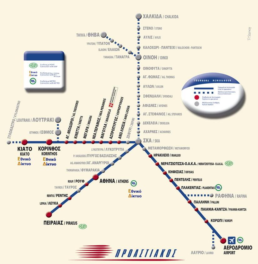
The proastiakos network covers a 120 klm long section and is forecast to have a full programming by 2010 that will span a length of 281 klm (see proastiakos map). Specifically, the now running routes are: Airport- Ano (Upper) Liosia and Piraeus - Kiato. Future routes of proastiakos include those reaching Chalkida, Thiva, Rafina, Lavrio, Loutraki and Xylokastro. Furthermore, there will be new stations in the areas of Tavros, Thymarakia, Ag. Anargyroi, Pyrgo Vasilissis, Lykotrypa, Zephyri, Metamorfosi and Acharnes.
Proastiakos trains are suburban trains, operating in and around Athens, Thessaloniki and Patras (as its mentioned in proastiakos map). Trains are operated with modern trains; on electrified lines TRAINOSE uses class 460 Desiro trains while on diesel lines class 560 GTW trains are used. The regional suburban train (Proastiakos) connects the Athens airport to the Athens main railway station (Larissis) and the Acharnai railway station, both of which are connected to the national railway network.