search
Athens bus routes map
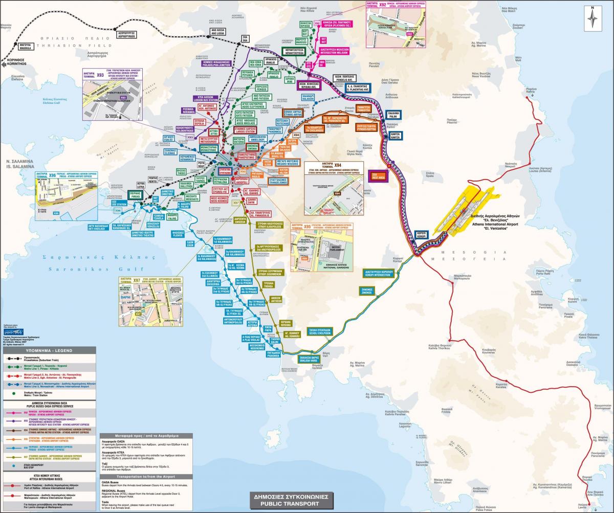
Athens greece bus routes map. Athens bus routes map (Greece) to print. Athens bus routes map (Greece) to download. There are some very small blue buses that go through central Athens on the small interior streets (as its shown in Athens bus routes map). The bus 035 routes goes from Athinas Street all the way to Kypseli. The 060 cruises between the National Museum and the Koloniki. There are several other Athens bus. You can find maps on many of the bus stops and you can also get one from the Greek National Tourist Organization office on Amalias street by Syntagma Square. The 040 bus goes from Syntagma to Pireaus. The 049 bus routes goes from Omonia to Pireaus.
A bus route linking the Athens International Airport at Spata to the port of Rafina in eastern Attica will be operated by the KTEL intercity bus system and will be called "Athens Airport-Rafina Port" (see Athens bus routes map). This Athens bus route will function daily from 6 a.m. to 9.20 p.m. with buses leaving every 40 minutes and making a stop in the seaside resort of Loutsa.
There are no nighttime buses in Athens, but some bus routes run 24 hours a day, and others just run on the weekends (see Athens bus routes map). The most important lines link Syntagma Square with Piraeus harbor and Kifisia. Most buses run between 5am and midnight. The frequency of Athens bus routes depends on the line and time of day.


