search
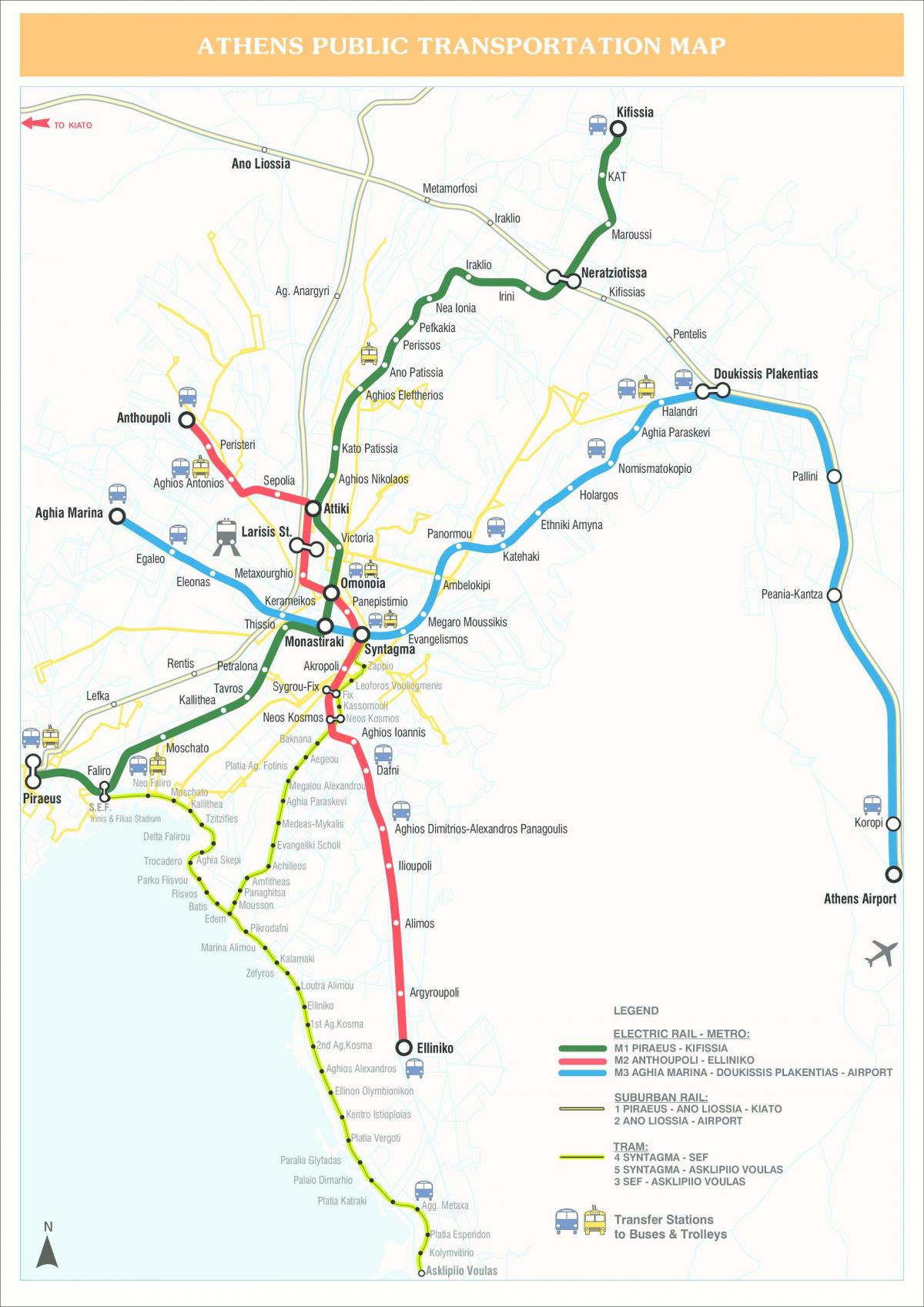
Athens train map
Athens train station map. Athens train map (Greece) to print. Athens train map (Greece) to download. All trains of Athens train map stop at all stations all the time, except of the section Airport – Douk. Plakentias of line 3 where trains run every 30 minutes (this section is shared with the Suburban Railway).There are also extra athens trains between Ano Liosia and Airport station as well as Ano Liosia and Koropi stations. From summer 2020 there are also trains connecting Athens Airport (as well as Piraeus) directly to Egio, near Patras.
There were two train stations side by side mentioned in Athens map, one for Northern Greece and the other for the Peloponessos, on Theodorou Diligiani street. The Peloponessos Athens train station is now closed, maybe permanently. The way to get to the Peloponessos now is to go from Athens to Corinth by '' Proastiako '' from Larissia train Station.
Athens metro line 1 is an overground train (known as ISAP) that runs from the northern suburb of Kifissia to the port of Piraeus (as its shown in Athens train map). It connects to lines 2 and 3 at three stations (Attiki, Omonia and Monastiraki). This overground athens train provides a direct link between Piraeus port and Athens International Airport. It also connects Athens to Halkida in Evia and Kiato and Corinth in the Peloponnese. The suburban railway operates from 4:30 am until 11 pm daily.


