search
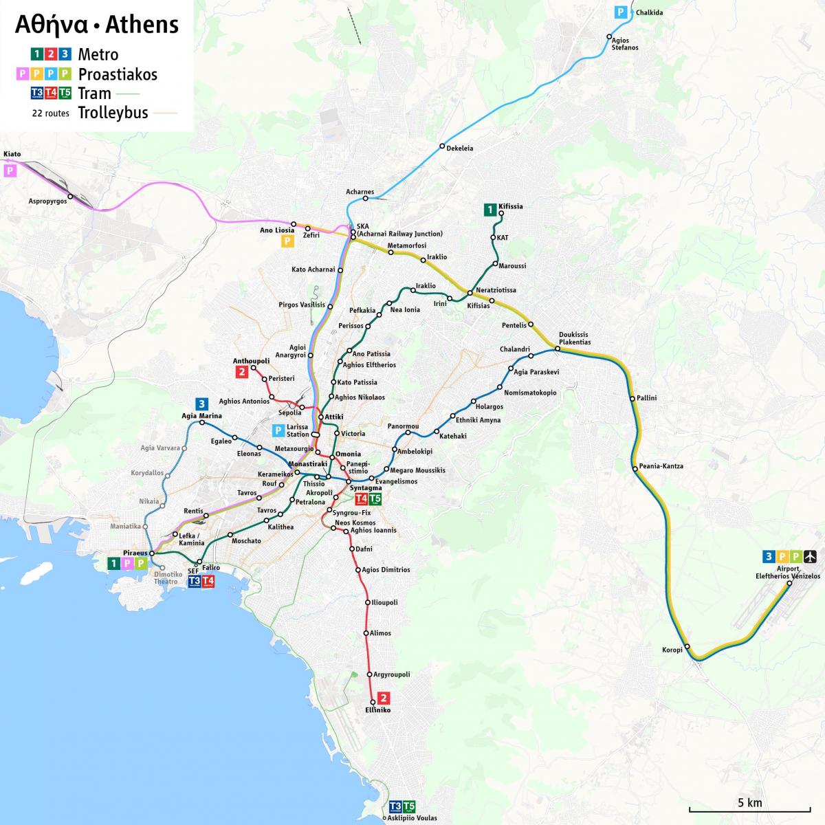
Athens greece metro map
Athens metro and tram map. Athens greece metro map (Greece) to print. Athens greece metro map (Greece) to download. Athens metro is a 135 km network serving 45 stations, recently extended throuw Greece thanks to the games, which will grow by 23 kilometers - 12 stations by 2009 and by 20,8 more kilometers (16 more stations) by 2012 (as its shown in Athens greece metro map). The brand new Athens metro system only has three lines but the clean and safe trains will take you to your destination and they will do so fast. During rush hour the trains run every 3 minutes and every 10 minutes the rest of the day.
The operation of Lines 2 & 3 of the Athens Greece metro started in 2000. The total length of the Athens greece metro network is 37,8 kilometers and the network includes thirty six (36) stations (SYNTAGMA station is double because is included both on line 2 and line 3). Furthermore, the "Eleftherios Venizelos" International Airport of Athens, as well as the area of Mesoghia are served with Metro trains for their immediate connection with the city center (as its mentioned in Athens greece metro map), through four (4) stations (Pallini, Paiania-Kantza, Koropi and Airport) of the network of Suburban Railway at a distance with a length of 20,7 kilometers.
Athens greece three Urban Rail Transport S.A. metro lines run every four to 30 minutes from 5 or 5:30 a.m. to 12:20, 1 or 2:20 a.m. daily and make multiple stops in and around Athens. Athens greece metro line 1 operates between Piraeus and the northern suburb of Kifisia and offers the closest stop (Monastiraki metro station) to Ancient Agora , making this a great option for sightseers and cruise ship passengers (as its shown in Athens greece metro map).


