
search
Athens tram map
Tram map Athens greece. Athens tram map (Greece) to print. Athens tram map (Greece) to download. The Athens tram no longer starts from Syndagma Square until the end of consolidation work (date unknown), but from Kassomouli station, then descends towards the south of athens (as its mentioned in Athens tram map), via the National Garden, before splitting into 2 branches. One continues via Glyfada to Voula (on the coast, south-east of the city). The other Athens tram joins Neo Faliro (southern district of Piraeus).The tram system has a fleet of 42 trams which serve 47 stations. It employs 345 operators and has an average daily occupancy of 80,000 people. The tram runs from Syntagma Square to the southwestern suburb of Palaio Faliro, where the line splits in two branches.
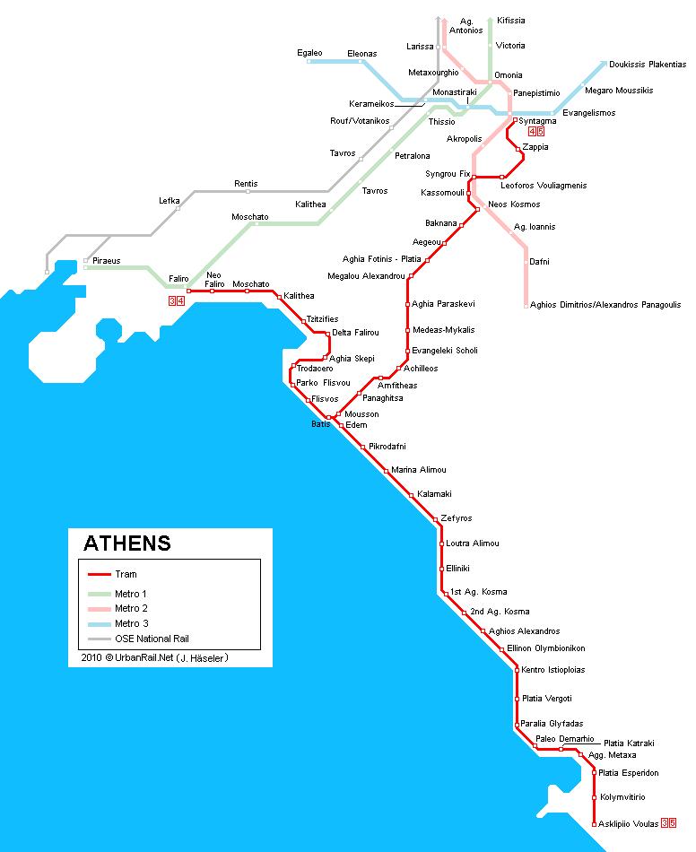
New, clean, ecological with routes along the coast of the Saronic Gulf, Athens trams are a real attraction in themselves. Although most travelers will probably not be aware of its existence, the Athens tram is one of the most beautiful ways to access athens coastal neighborhoods. Its routes along the Saronic Gulf are of real interest (as its shown in Athens tram map).
The first tram in Athens started operating in 1882 (see Athens tram map). These early vehicles had 16 seats and were pulled by three horses. In 1887, steam-powered trams began to gradually replace animal-drawn streetcars. In October 1908, the first electric Athens tram began to operate. Although it was a very popular troop transport during World War II, the tram fell into disuse in the following years. In 1960, the last ride was made. It was only since the Athens Olympic Games in 2004 that the tramway became part of Athenian life again.