
search
Athens agora map
Map of Athens agora. Athens agora map (Greece) to print. Athens agora map (Greece) to download. The avenue leads down to the Athens agora (as its shown in Athens agora map), which the American School of Classical Studies started restoring in 1931, paying $2.5 million compensation to the several hundred families living there. Financed by, among others, the Rockefeller Foundation, the Marshall Plan, and the Greek government, the work went on until 1960. Athens agora includes what has been called “the pitiless replica of a 180-columned portico of the 2nd century BC,” which serves as a museum.
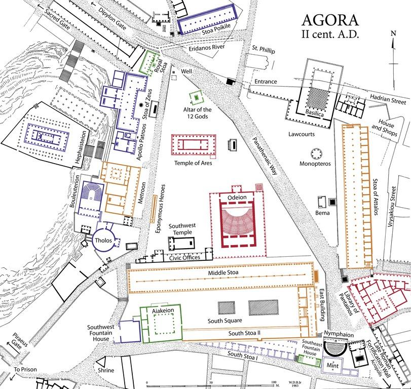
The agora was the heart of ancient Athens, the focus of political, commercial, administrative and social activity, the religious and cultural centre, and the seat of justice. The site was occupied without interruption in all periods of athens history. Athens agora was used as a residential and burial area as early as the Late Neolithic period (3000 B.C.). Early in the 6th century, in the time of Solon, the Agora became a public area (see Athens agora map).